The UAV / UAS industry seems to have grown at such an incredible rate. It can be hard to define or even count all the drone training programmes, drone courses and drone-related applications out there.
What about the number of companies involved either in the development of drone platforms or in dealing with GNSS, Lidar, and more?
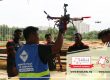
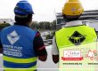
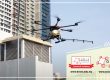
Due to their ability to reach previously inaccessible locations, the use of drones can now be found in search and rescue operations, in use for mapping and surveying, and in other civil applications for the police and for firefighting.
Studies seem to show that the emerging global market for business services using drones might be worth more than $125 billion at some point.
Here are several developments highlighting the drone industry’s technology integrations, innovative applications, and more.
Sensor Integration
As sensors get smaller, capturing images using drones could get even simpler. Advances in sensor tech can impact two main areas: data quality, and automation.
When better visual and thermal sensors capture higher resolution images, expect even more precise and user-friendly data from drones.
New sensors can be used by a drone controller to direct the flight path of a drone, maintain a consistent distance from a structure or the ground to enable automated flights, and improve measurement accuracy. We can even expect to find chemical sensors that are developed and attached to drones in order to gather more information on an environment’s chemical composition.
Evolving measurement features
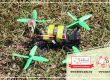
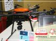
Advanced measurement capabilities are also made possible through the use of drones. You might have heard that Lidar (Light detection and ranging), has been used to help detect and measure the distance of an object or a surface from a specific optical source (such as a hovering or cruising UAV).
The M200 Snoopy series Lidar package from LidarUSA is a model that has apparently been designed specifically for integration aboard the DJI M200 UAV with a laser scanning feature that spans a 100-meter maximum range, yielding 4-5 cm accuracy. It purportedly also carries a tactical grade L1/L2 GPS/IMU unit and weighs 1.63 kg.
You might have also heard about Inertial Miniaturization, which acts as a navigation sensor addition. The miniature μIMU from Inertial Sense incorporates a magnetometer, barometric pressure sensor and L1 GPS (GNSS) receiver. Linear acceleration, angular rate, barometric altitude, magnetic field and GPS location outputs have been set at 1 kHz with UTC time synchronization.
Improved Regulatory Outlook
Having proper policies in place can help technological progress. While they may have previously been considered emerging technology, drones appear to have attracted the attention of policymakers.
With drones being found in commercial use, it’s likely that many businesses require improved standards for safety and delivery. Governments that deal with bringing drones into national airspaces may have many restrictions which limit the use of UAVs. These days, you might find improved regulation and more flexibility coming from regulatory bodies that work with government agencies.
We can expect a regulatory infrastructure that’s more conducive to the drone industry in the coming years, particularly since the establishment of Part 107, purported to be a flexible, risk-based approach to regulating UAS, which may remove many barriers to low-risk civil and commercial drone operations.
Since its enactment in 2016, the demand for commercial drone applications has apparently increased rapidly.
Counter-UAS Systems
DroneShield markets a drone detection and mitigation system out of Australia, and is known for its DroneGun, a point-and-shoot device capable of simultaneously disrupting several RF frequency bands (433MHz, 915MHz, 2.4GHz & 5.8GHz) and cutting communication ties to a drone operator.
Survey and Mapping
The construction industry also benefits from enhanced capabilities for surveying, where drones are able to quickly obtain detailed, accurate and high-grade data to help companies save time and resources. On top of this, drones also help with reducing human proximity to dangerous quarry sites through optimised mapping tasks, which leads to better safety measures.
SenseFly used its eBee Plus drone for a construction project in Northern Ireland to help build the new A6 highway. Their UAV allowed for detailed and integrated aerial coverage and a significant reduction in interruptions.
High-Precision Survey Drones like the TRIUMPH-F1 UAV (built around the JAVAD GNSS TRIUMPH-1M receiver) is also making headlines as a drone that uses user-friendly mission programming and a host of other features to prioritise incredible accuracy while surveying.
WingtraOne’s vertical landing technology is also an impressive addition that lets drones touchdown in extremely confined areas (even as small as 2mx2m).
This could give drones the ability to work in places like forest lanes and also reduce the possible damage from belly landings or parachute takedowns.
These examples just skim the surface of an exciting industry that keeps on developing new technologies and applications at a rapid rate. What seems clear is that these fascinating little machines have only begun their journey. Expect to see better, more innovative solutions in the coming years.
.
Asia Drone IoT Technologies lets you leverage the incredible power of drone technology for career advancements, industry applications, and learning. Find out more about:
Solutions at asiadronetech.com
Recent engagements at our Facebook page
Training programmes at drone.edu.my